The landscape at the Colo Ponds has changed remarkably since I last wrote about the ponds in 1984 (Zaletel 1984). At that time, there was no publicly owned land; it was farmed each year. During wet years, extensive mudflats and potholes offered ideal habitat
for shorebirds and puddle ducks.
Jump start to the present and you will find that nearly 625 acres of land are owned or managed by the Iowa DNR; thus, the name Colo Bogs Wildlife Management Area. Thanks to the efforts of Story County Pheasants Forever and many environmental and governmental agencies, this has been accomplished since 1995.
With public ownership, prairie grasses and flowers have been planted. Tiles have been broken, non-perforated tile installed, and dikes built. The habitat has been radically altered. It will be many years before the effects of these changes are reflected in its birds
and wildlife.
The wetland complex is located 2.5 miles east of Colo in Story County (Figure 1). It can be reached by taking County Road E41 (The Lincoln Highway) or U.S. 30. The complex is located approximately one mile west of the terminal moraine of the Wisconsin
glacier, which passed through 10,000 years ago.
The bog, a result of its glacial history, has been studied extensively by soil scientists, many papers have been written, and there are many references about its uniqueness in texts.
The tour will start on County Road E41 just past 720th Avenue, a north/south road. Directly east of the farmstead on the northeast corner is a sheep pasture (Figure 1.1). Here, almost every shorebird on the IOU checklist has been seen including Black-necked
Stilt, American Avocet, and Marbled Godwit. Two species of ibis, Eared Grebe, Sandhill Crane, Cattle and Great Egret, and Least Tern are some of the other unusual sightings that have been found here.
Before County Road E41 was paved in the late 1920s, the old Lincoln Highway (Figures 2 and 3) went through the middle of a large wetland. Today, in wet years, the water extends to the road’s edge (Figure 1.2). American Coots and Pied-billed Grebes
are frequent nesters.
On the south side of the road, dikes have been built. Blue-winged and Green-winged Teal, Northern Shovelers, and Marsh Wrens have nested in past years.
Figure 1. Birding Colo Bogs Wildlife Management Area: (1) sheep pasture, (2) wetland at road’s edge, (3) parking lot, (4) large northwestern wetland, (5) long, linear wetland along north edge of WMA, (6) pasture, (7) wetlands at corner, (8) wetland west of parking lot, (9) wetland farther west of parking lot, (10) original bog, (11) wetlands south of bog.
Birders should be warned that the shoulder of the road is narrow and that traffic at times can be disruptive. I have been stopped here by the Iowa Highway Patrol. They insist that all vehicles must be completely off the traveled surface of the road.
Proceed to the parking lot (Figure 1.3) on the north side of the road. Walk north from the lot. Sometimes there is a path and other times there is not. Knee-high boots are recommended. Ticks are common as well as mosquitoes. Because of a slight elevation, the wetlands on the other side of the rise are not visible from the road.
As you walk north, you will notice many of the 100 wind turbines (Figure 4) that are located just one mile from the wetland complex. Because they are new this year, it is to be determined whether they will have an effect on the birdlife of the area.
A large wetland will appear on your left to the northwest (Figure 1.4). Expect to hear Marsh Wrens and see Yellow-headed Blackbirds. Common Yellowthroats will scold you.
An even better place to see Yellow-headed Blackbirds is along a long, linear wetland (Figure 1.5). In recent years, American Bitterns are frequently heard but seldom seen.
Listen for the call of the Upland Sandpiper. They usually can be found anywhere along the long wetland. They also can be found in a pasture directly north of the complex (Figure 1.6).
Sitting on the fence separating the pasture from the wetland complex, one can usually find Bobolinks and Dickcissels. Looking east from the road, the linear wetland continues. Waterfowl can frequently be seen during migration.
At the corner of E41 and 730th Avenue, there are wetlands (Figure 1.7) on both sides of the road during wet periods. Your car provides an excellent blind to view the puddle ducks and shorebirds that are present.
During migration, Northern Harriers are commonly seen. In winter months, Short-eared Owls sometimes can be found at sunset patrolling the prairie.
From County Road E41, go south over the railroad tracks on 730th Avenue. There is a parking lot at the top of the hill. A Dickcissel as well as a Western Meadowlark nest here during the summer.
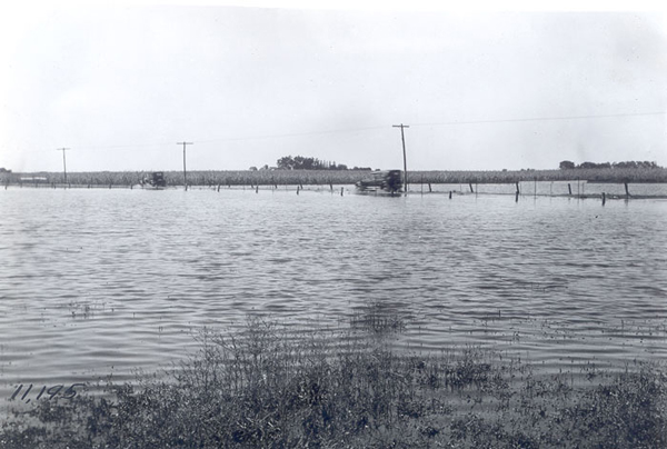
Figure 2. Looking northwest toward unpaved Old Lincoln Highway (County E41), the first U.S. transcontinental highway, as it went through the middle of the wetland in the mid-1920s. Photograph is from the Iowa Department of Transportation’s photo collection.
From the parking lot, walk west to the wetland (Figure 1.8). Year round water guarantees an ever changing bird population. Muskrat populations determine cattail numbers and the breeding numbers of water birds. Blue-winged and Green-winged Teal, Northern Shoveler, Ruddy Duck, American Coot, Common Moorhen, Spotted Sandpiper, Tree Swallow, Yellow-headed Blackbird, and Great-tailed Grackle have nested at this wetland.
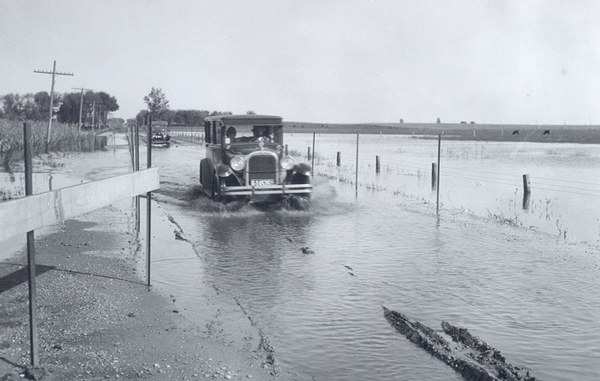
Figure 3. Looking east as mid-1920s cars attempt to travel along the unpaved Lincoln Highway (County E41) as it went through the middle of the wetland. Note the license plate numbered 6, which designated Benton County then! Photograph is from the Iowa Department of Transportation’s photo collection.
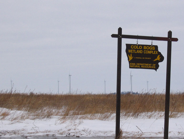
Figure 4. Some of the many new wind turbines recently erected to the northwest of the Colo Bogs WMA, 20 January 2009. Photograph by Hank Zaletel, Nevada, IA.
American Bittern, Virginia Rail, and Sora have been seen during breeding season but nesting has not been positively confirmed. Black Tern is always a possibility during the summer.
Walking west, a wetland (Figure 1.9) was just developed and offers great promise. This wetland cannot be seen from the parking lot. Further west is the original bog (Figure 1.10). During the summer of 2008, a night roost of up to 25 Great Egrets would come in
at sunset and spend the night in the willows.
To the west, on 720th Avenue from U.S. 30 to County Road E41, is a dirt road. Even after modest rains, the road is impassable. In wet years, portions are under water.
The wetlands south of the bog (Figure 1.11) are largely unexplored. Viewing points are poor, mosquitoes thick, the water is deep and the cattails are tall. The dirt road on the west is impassable for considerable portions of the spring and summer.
I have birded the Colo Ponds since 1977. Each trip is an adventure as one never knows what will be seen. During wet years, chances of seeing good birds increase. I would highly recommend the ponds for shorebirds during the spring migration in wet years as they can be easily viewed in great numbers from your car.
LITERATURE CITED
Zaletel, H. 1984. Finding water birds in eastern Story County. Iowa Bird Life 54:27–29.